8K 5G GPS Dual-Camera Drone: Shoot Smoother Aerials
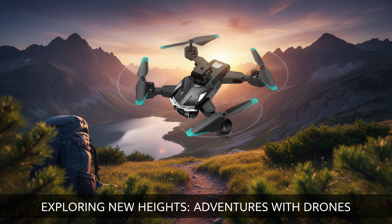
8K 5G GPS Dual-Camera Drone for Aerial Photography: What to Expect and How to Use It Well
A GPS-assisted dual-camera drone can make aerial photos and video easier to plan, steadier to capture, and simpler to repeat across multiple takes. Whether you’re filming a listing, grabbing travel b-roll, or learning the basics of smooth cinematic movement, the right features (and a few good habits) make a bigger difference than flying “farther” or “faster.” Below is a practical breakdown of what GPS and dual cameras change in real-world shooting, plus a workflow that helps you get usable footage from the first session.
Who This Drone Fits Best
- Real estate and property walkthroughs that benefit from repeatable flight paths and consistent angles
- Outdoor creators capturing landscapes, beaches, trails, and travel footage with stabilized hovering and return-to-home support
- Content teams needing quick establishing shots, overhead b-roll, and safer distance framing
- Hobby pilots who want GPS positioning and a dual-camera setup for wider coverage
If your goal is reliable composition—hovering for stills, repeating a “reveal” shot, or keeping framing stable while you adjust—GPS support is one of the most noticeable quality upgrades.
Key Features That Matter for Aerial Photography
Spec sheets can look impressive, but aerial image quality is usually decided by stability, controllability, and predictable behavior in the air. Here are the features that most directly affect what you bring home from a shoot:
- GPS positioning helps maintain location hold for cleaner stills and smoother composition changes.
- Dual-camera design can support switching perspectives quickly (for example, wider scene coverage vs. closer framing) without landing.
- High-resolution capture (marketed as 8K) can provide flexibility for cropping and reframing, but results also depend on sensor quality, stabilization, and lighting.
- 5G/Wi‑Fi transmission (as advertised) can improve the live view experience, but range and stability depend on environment, interference, and local regulations.
Feature-to-Outcome Map
| Feature | What it helps with | What to watch for |
|---|---|---|
| GPS flight support | More stable hover and repeatable shots | Allow time for satellite lock; avoid flying near magnetic/metal interference |
| Return-to-Home style functions | Safer recovery if signal drops or battery runs low | Confirm home point; test at low altitude first |
| Dual cameras | Faster switching between angles during a session | Practice transitions; check exposure differences between lenses |
| High-resolution video modes | More room to crop and stabilize in editing | Large files; ensure adequate storage and smooth playback workflow |
| Live video transmission | Better framing and timing for moving subjects | Signal can degrade near buildings, trees, or busy wireless areas |
Planning a Shoot: Simple Steps That Improve Results
A little structure on the ground saves battery, reduces risk, and usually delivers better footage. For most locations, this lightweight plan covers the essentials:
- Scout the location: identify obstacles, wind corridors, and safe takeoff/landing zones.
- Pick two or three core shots: a wide establishing pass, a reveal move, and a top-down detail shot to reduce time in the air.
- Schedule around light: early morning or late afternoon tends to produce better contrast and less harsh glare.
- Set a maximum distance and altitude: decide limits before takeoff to keep framing predictable and retrieval easier.
For real estate work, consider prepping the property first so the drone session is focused and quick. A clean, uncluttered exterior and entryway helps aerial footage feel intentional; tools like a Smart Home Robot Vacuum Cleaner with Mop & Automatic Dust Collection can help speed up interior-ready presentation when you’re capturing both indoor and outdoor content in the same day.
Flight Habits for Smoother Footage
The difference between “watchable” and “polished” footage is often pilot rhythm. These habits are simple, but they stack:
Battery, Storage, and a Simple Post-Flight Workflow
Safety and Compliance Basics
Better footage starts with safer decisions. Before flying, verify what’s allowed where you are and what’s required for your type of use. In the U.S., FAA resources are a solid starting point for recreational and commercial guidance: FAA – DroneZone and Getting Started (UAS). Also remember that wireless features and radio equipment are regulated; for general background on authorization and compliance, see FCC – Wireless Device Equipment Authorization (Overview).
Product Snapshot: 8K 5G GPS Dual-Camera Drone
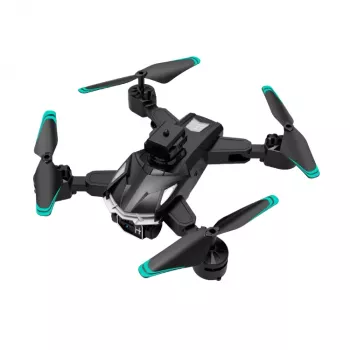
If you want GPS-assisted hovering, a dual-camera setup, and high-resolution capture options in a single platform, the 8K 5G GPS Dual-Camera Professional Drone for Aerial Photography is positioned for general aerial b-roll, landscapes, and property-style establishing shots—especially when conditions are calm and you prioritize repeatable framing.
At-a-Glance Details
| Item | Detail |
|---|---|
| Product | 8K 5G GPS Dual-Camera Professional Drone for Aerial Photography |
| Price | 162.51 USD |
| Availability | In stock |
| Product page | View current availability and pricing |
Helpful add-ons for content workflows
- How to Pick Dining Chairs Checklist (Digital Download) for quick staging decisions in property content creation.
- Smart Home Robot Vacuum Cleaner with Mop & Automatic Dust Collection to help streamline clean-ready interiors when your shoot day includes both ground and aerial assets.
FAQ
Does GPS make aerial photos sharper?
GPS mainly helps the drone hold position more steadily, which can reduce drift during still photos and make framing easier. Sharpness still depends on lighting, shutter speed, vibration control, and how smoothly the drone is handled.
What is the benefit of a dual-camera drone for shooting content?
A dual-camera setup can let you switch perspectives faster so you can capture wide context and tighter details in the same flight. To keep results consistent, it helps to practice switching smoothly and to watch for exposure or color differences between lenses.
What should be checked before the first flight?
Charge batteries, confirm props and arms are secure, complete any required calibrations, and wait for satellite lock. Set/confirm the home point and return-to-home behavior, test controls at low altitude, and verify local flight rules before flying higher or farther.













Leave a comment